


A 7.8-magnitude earthquake struck the southern Philippines on Monday, killing at least one person, collapsing buildings, and sparking tsunami warnings across the region.
Authorities in the Philippines and Indonesia urged residents in affected coastal regions to move to higher ground immediately, after the offshore quake hit about 24 kilometres west of Mindanao island’s Sarangani province, the United States Geological Survey said.
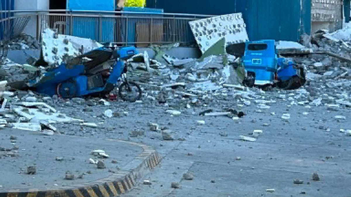
The earthquake caused the collapse of at least one building in General Santos, a tuna-processing city of more than 700,000 people that is also a commercial hub in the south.
“As of now, there is one reported death and four injured. This is only an initial report,” said Master Sergeant Robert Dagon of the General Santos City police.
“Many buildings were affected, but I cannot enumerate them now because we are busy with ongoing rescues,” he added.
Videos posted to social media showed a shopping centre with a Jollibee fast food restaurant reduced to rubble in General Santos, while a school building that officials said was unoccupied crumpled in another city.
Philippine President Ferdinand Marcos suspended school classes in affected areas of Mindanao while calling on residents in coastal areas to evacuate immediately.
“Move to higher ground now. Do not wait,” he said. “Your life is more important than anything left behind.”
Tsunami warnings triggered
The powerful earthquake triggered tsunami warnings across several countries in the Pacific.
The Philippine Institute of Volcanology and Seismology monitored 1-metre waves in the provinces of Sultan Kudarat and Sarangani, and the Pacific Tsunami Warning Center (PTWC) said tsunami waves up to 3 metres were possible on some coasts of the Philippines.
The PTWC also said in a notice that tsunami waves were possible “within the next three hours” along the coasts of the Philippines, Indonesia, Palau, Taiwan and Papua New Guinea.
Indonesia’s national disaster agency, meanwhile, instructed officials in the North Sulawesi capital, Manado, northern Gorontalo province and the Sangihe islands “to immediately direct their residents to evacuate in an orderly manner to higher ground”.
Japanese authorities separately issued a tsunami advisory for swathes of its Pacific coast, projecting waves of up to one metre to hit different regions from 11:30am local time.
Malaysia’s Meteorological Department issued a tsunami warning for Sabah state on Borneo island and smaller sea changes were possible in Taiwan, Japan, Papua New Guinea and several island nations and territories in the western Pacific. An advisory for Guam was lifted about two hours after the quake and there was no threat to Hawaii, the PTWC said.
The strongest earthquake to hit the Philippines this year was was centered at sea about 13 kilometers (8 miles) southwest of General Santos and was caused by movement in the Cotabato Trench at a depth of 10 kilometers (6.2 miles), according to the Philippine Institute of Volcanology and Seismology.
Aftershocks up to 6.5 magnitude followed, the U.S. Geological Survey said. It measured the original quake at 55 kilometers (34 miles) deep. Variations in measurements by different agencies are common in the immediate aftermath of an earthquake.
Earthquakes are a near-daily occurrence in the Philippines, which is situated on the Pacific “Ring of Fire”, an arc of intense seismic activity stretching from Japan through Southeast Asia and across the Pacific basin.
Eastern Mindanao was rocked by a pair of earthquakes of 7.4 and 6.7 magnitude in October that killed at least eight people.
Additional sources • AP, AFP


